

You're still here! Groovy. :) Thanks in advance for 5 minutes of your time. *Starts stopwatch*
I must say, Mount Pikchuck has got to be my favorite hike by far that I have done. Very beautiful the whole way with many, many viewpoints along the way! But first, where is this badboy located?
It was about a 2.5 hour drive from Tacoma, Washington; worth every second of traffic on the way home. We started early, got there around 9 AM. Even the views from the parking lot were great enough to be a summit vista of their own.
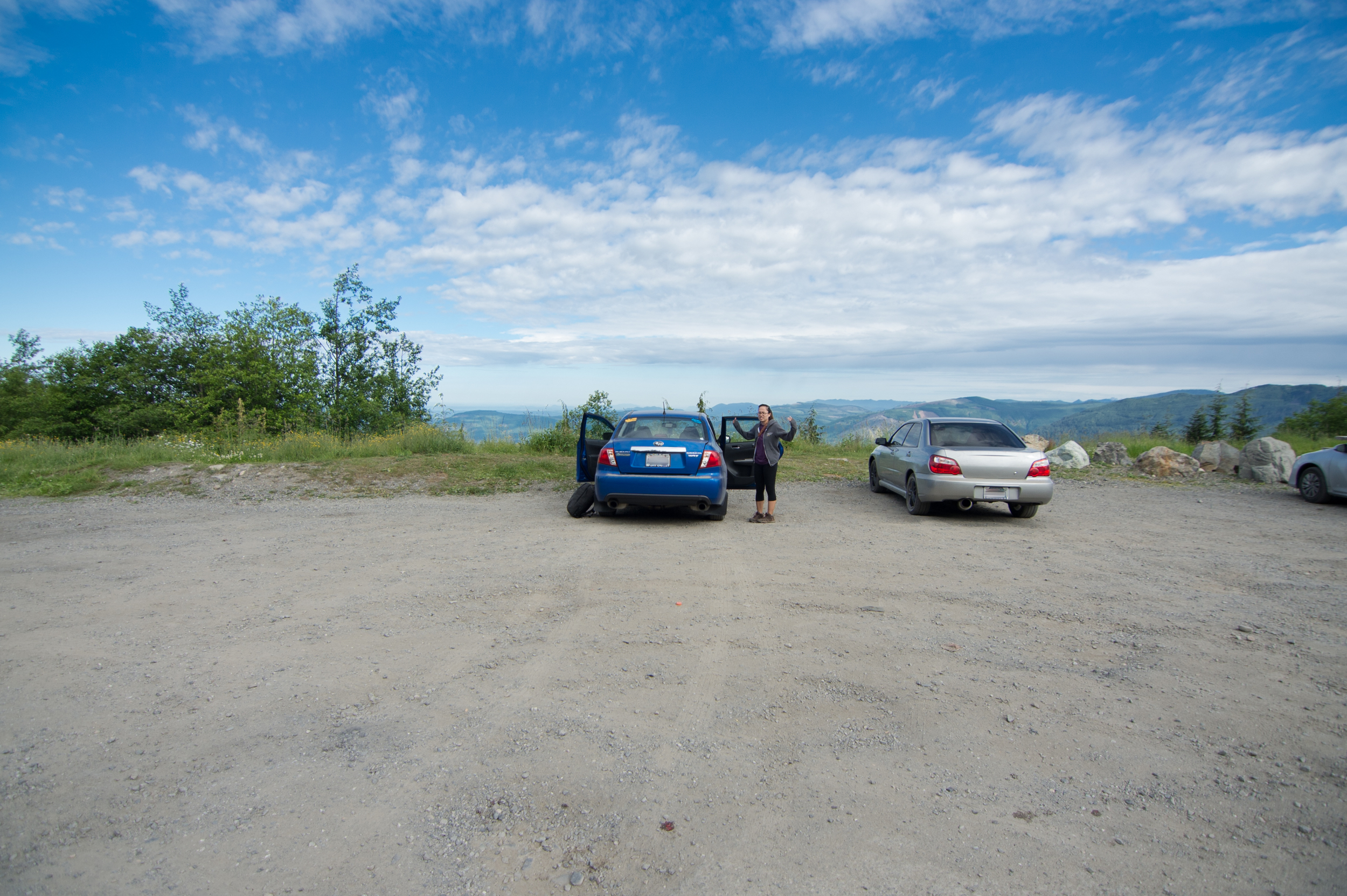
I mean, it makes sense. To get to the parking lot you drive up like a 5-mile pothole-riddled dirt road that has a 3,000-foot elevation gain of its own. It was really fun in my Subaru! Gotta love dat AWD, baby. ;)
The trailhead is really easy to spot, right next to a billboard with all the important things you see at every trailhead ever. A little ways up the trail you see these warning signs and a sign-in box.


That warning sign? If you are like me, then you read that sign and you think to yourself, "Bad. Ass". Don't let it scare you, the trail is far easier to follow than this warning makes it seem. I can definitely see how people could get lost if they didn't know how to hike or read trails for tracks.
If you decide to turn around and leave, seeyuh! Enjoy your multi-hour drive home! Otherwise, put your epicpants on and lace up your radshoes, 'cause this mountain knows how to party.
This hike is broken up into 3 sections.
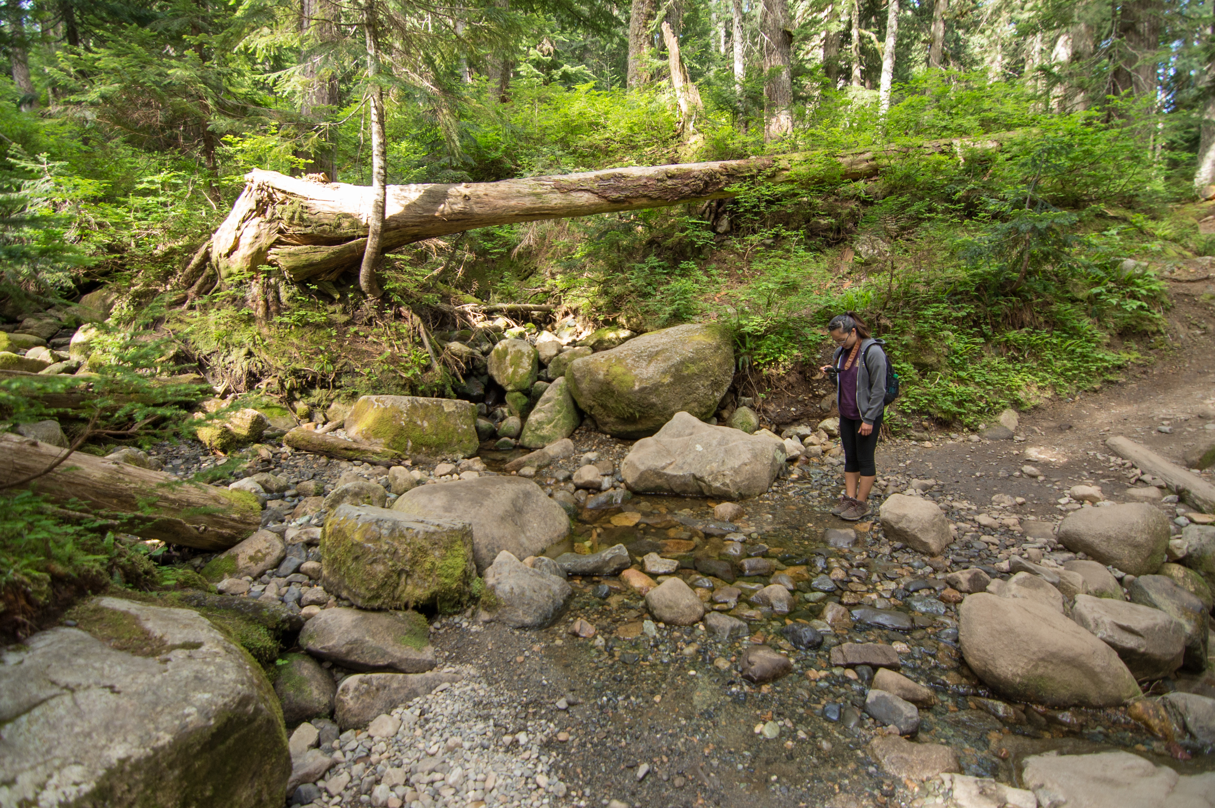
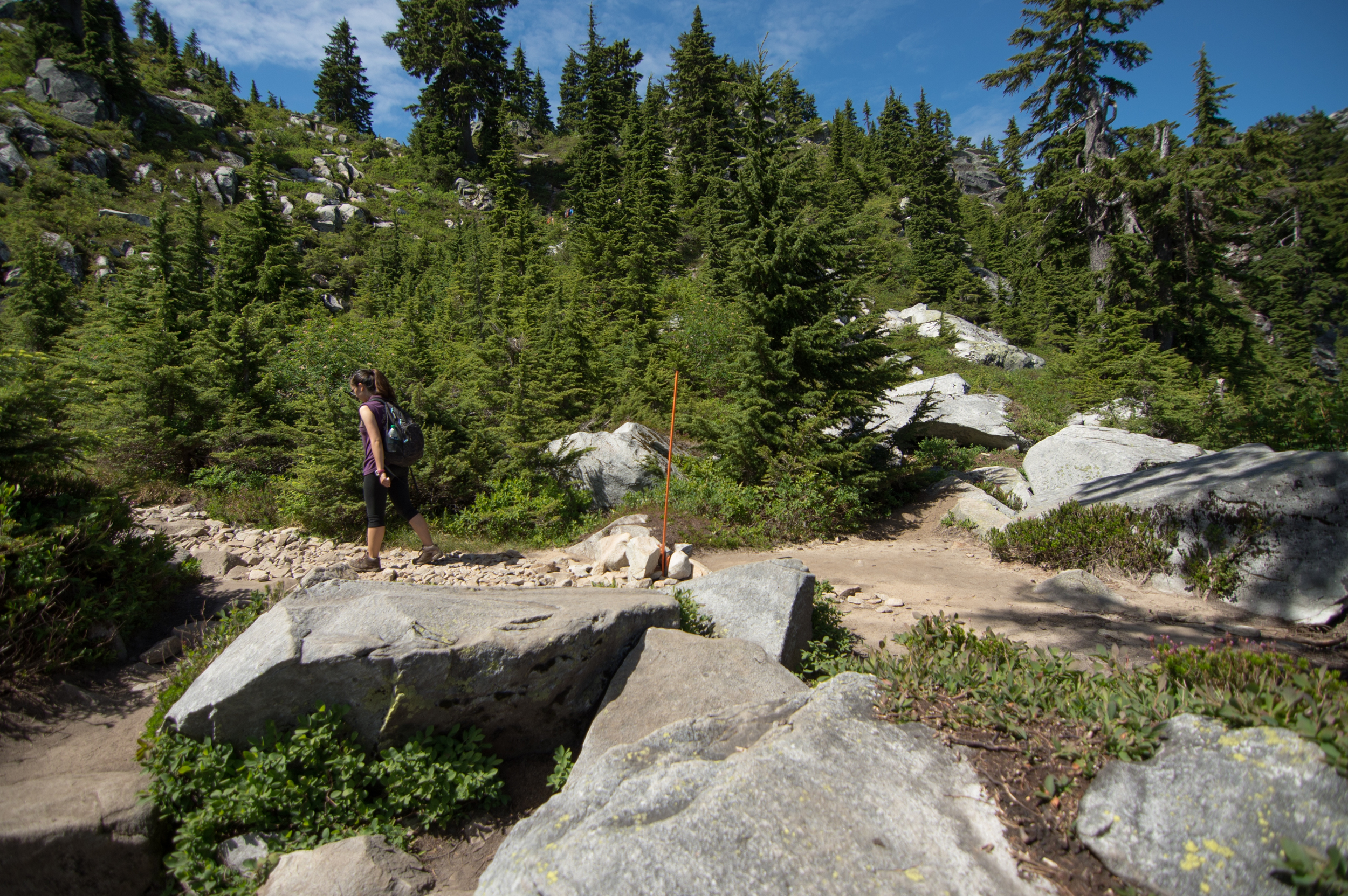
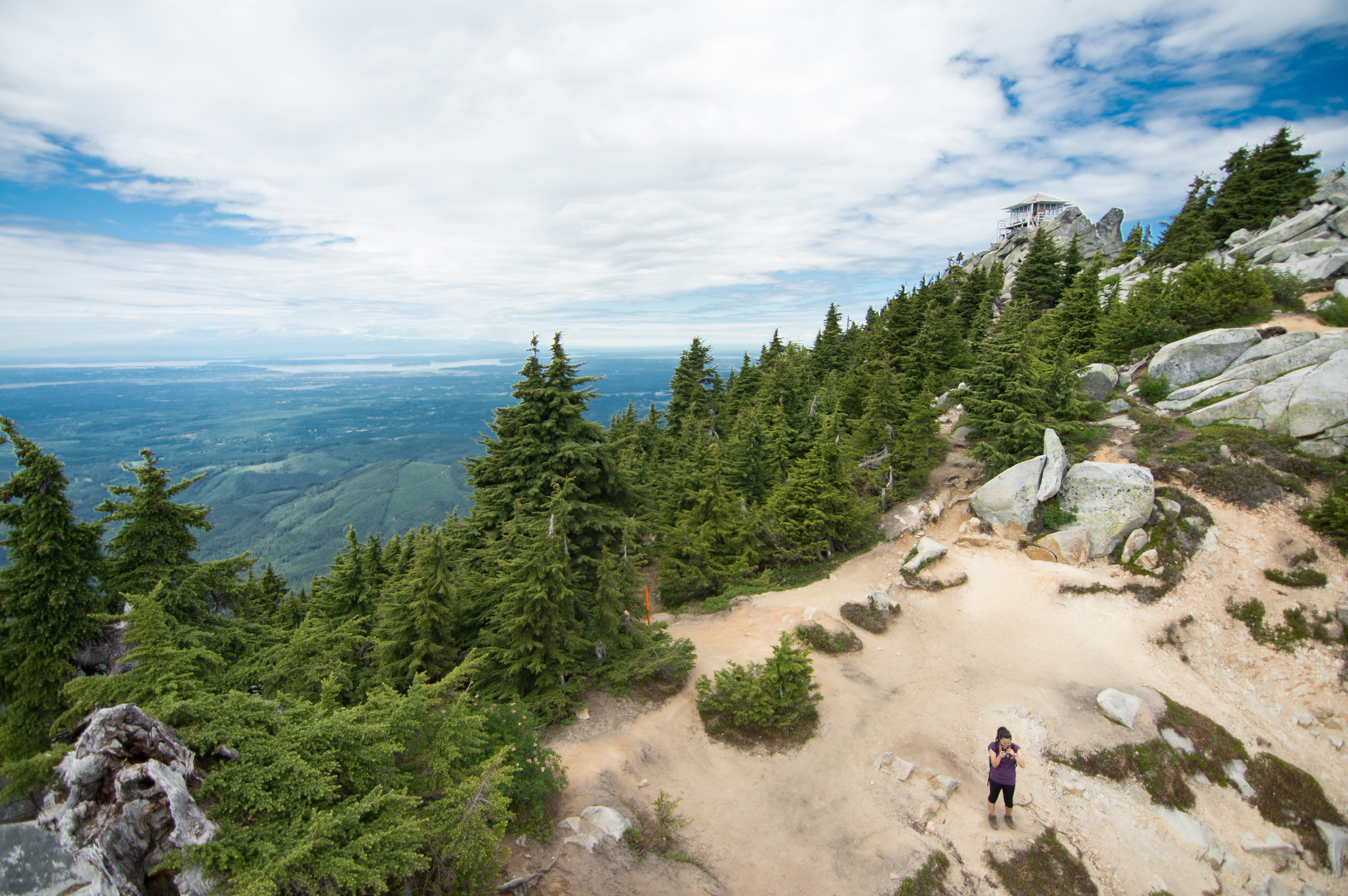
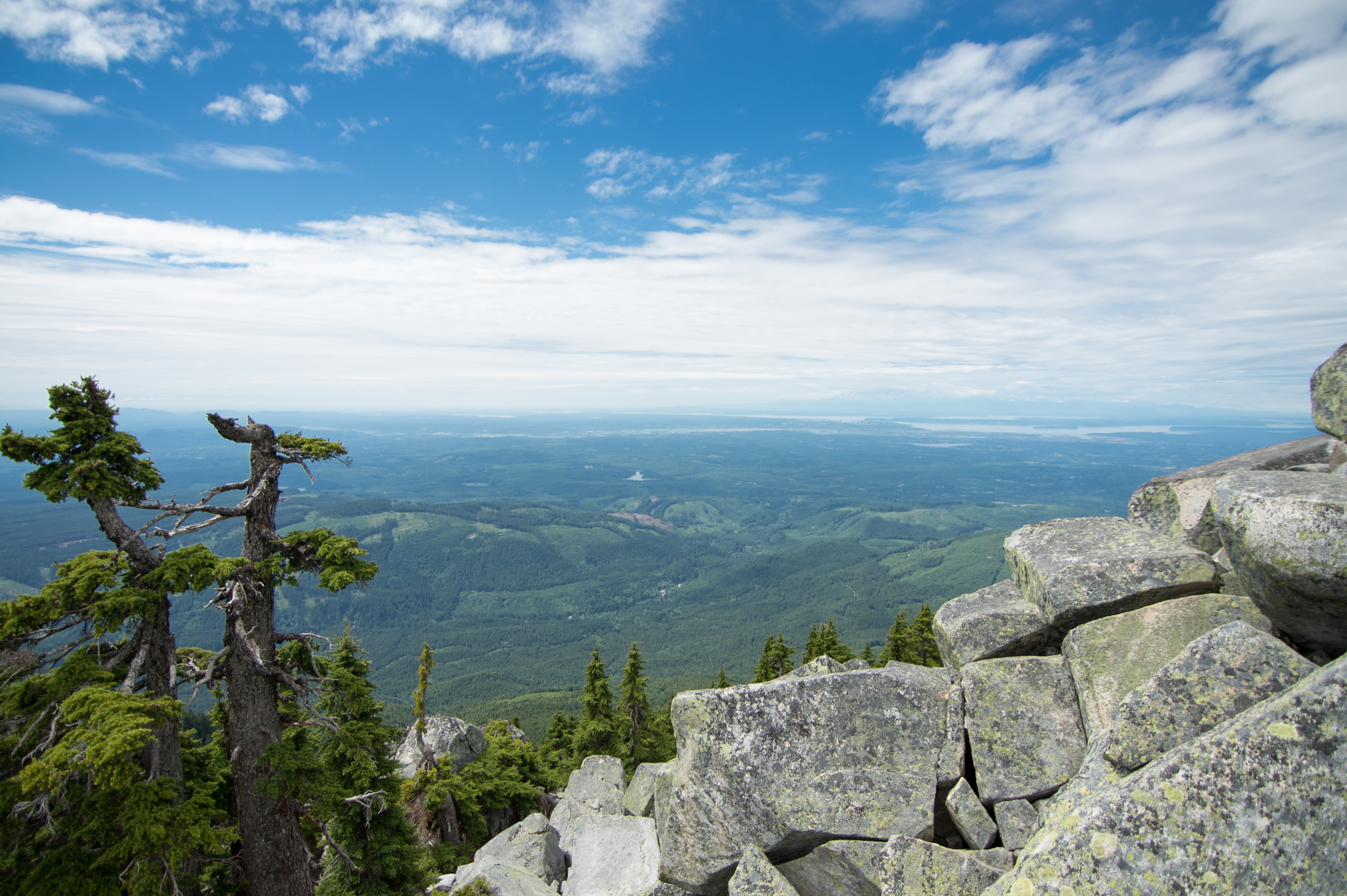
The first section is very wooded, lots of trees and lookout points. There are many manmade steps, both stone and wood, that help make forging ahead along the trail a bit easier. Towards the end of this section there's a large clearing with a massive wall of boulders.

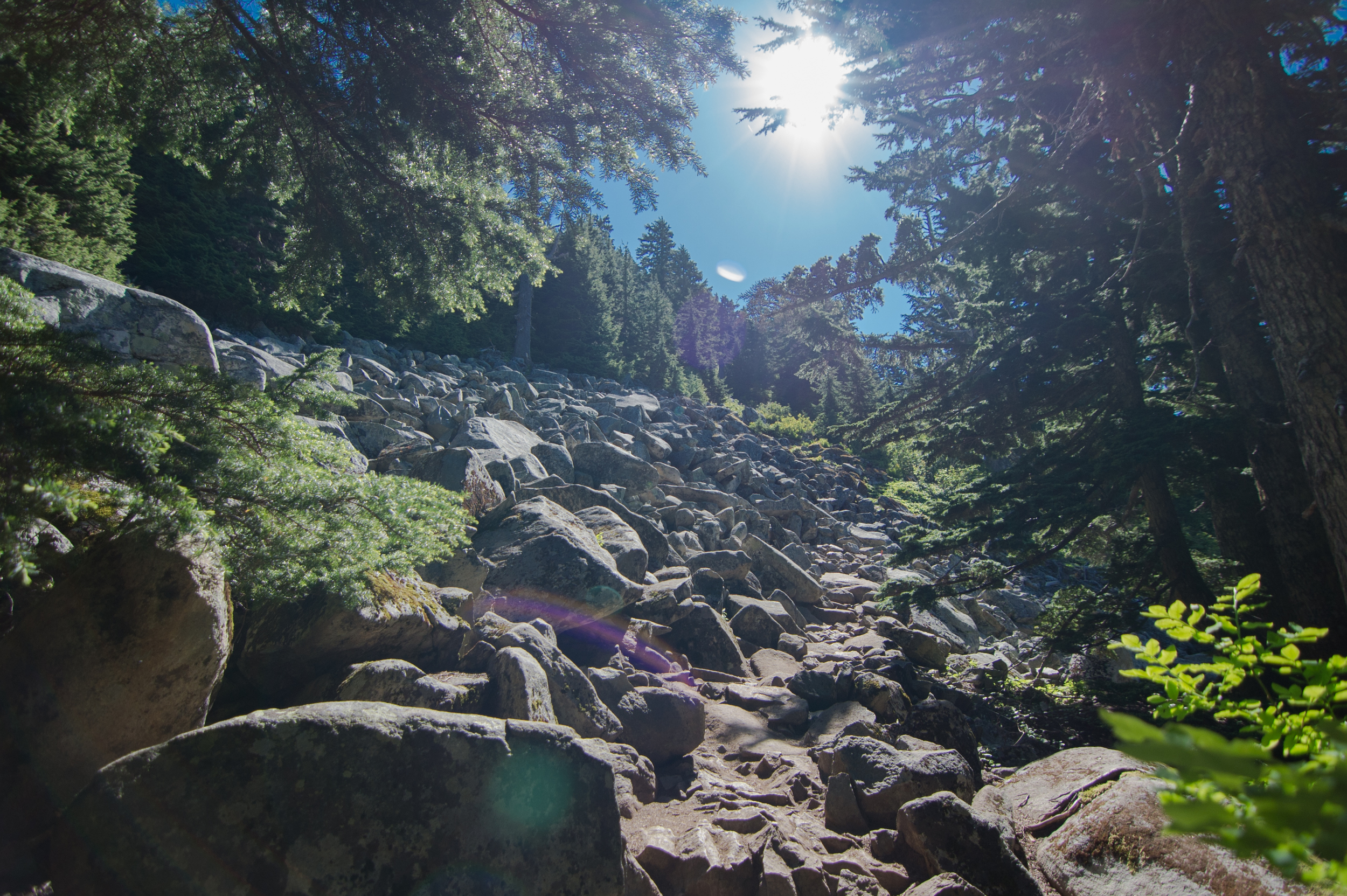
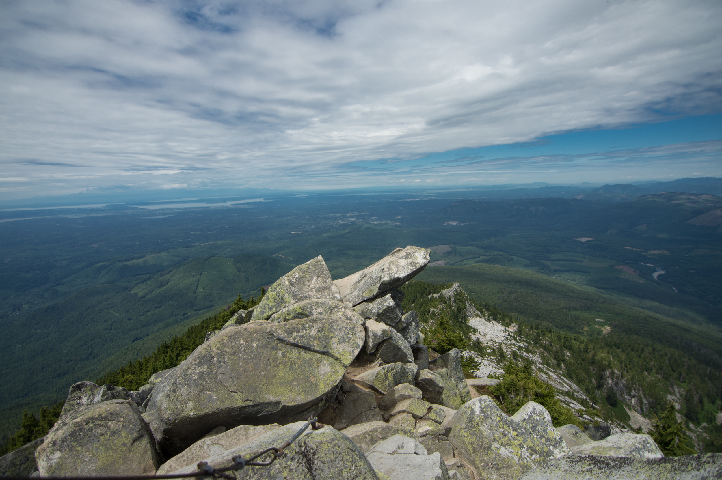
See that little broken orange marker? Yeah, I didn't see it either until a fellow hiker pointed it out to me. It shows up on your right hand side, as you look out to see a small, beauty of a clearing. IMPORTANT: DO NOT SCRAMBLE UP THESE ROCKS! This will take you somewhere, I don't know, somewhere you aren't trying to go? And you'll get lost? I think? Don't know, didn't do it. Neither should you... unless, of course, you are into being search-and-rescued by the Ranger station. I mean, whatever floats your boat. ANYways, What you should do is stand with that marker on your left, look back at the way you came, and look slightly to the right of that. You'll see (very faintly) a light brown dusting along a trail that takes to you up over some rocks and out to the second section of this glorious naturemaze.
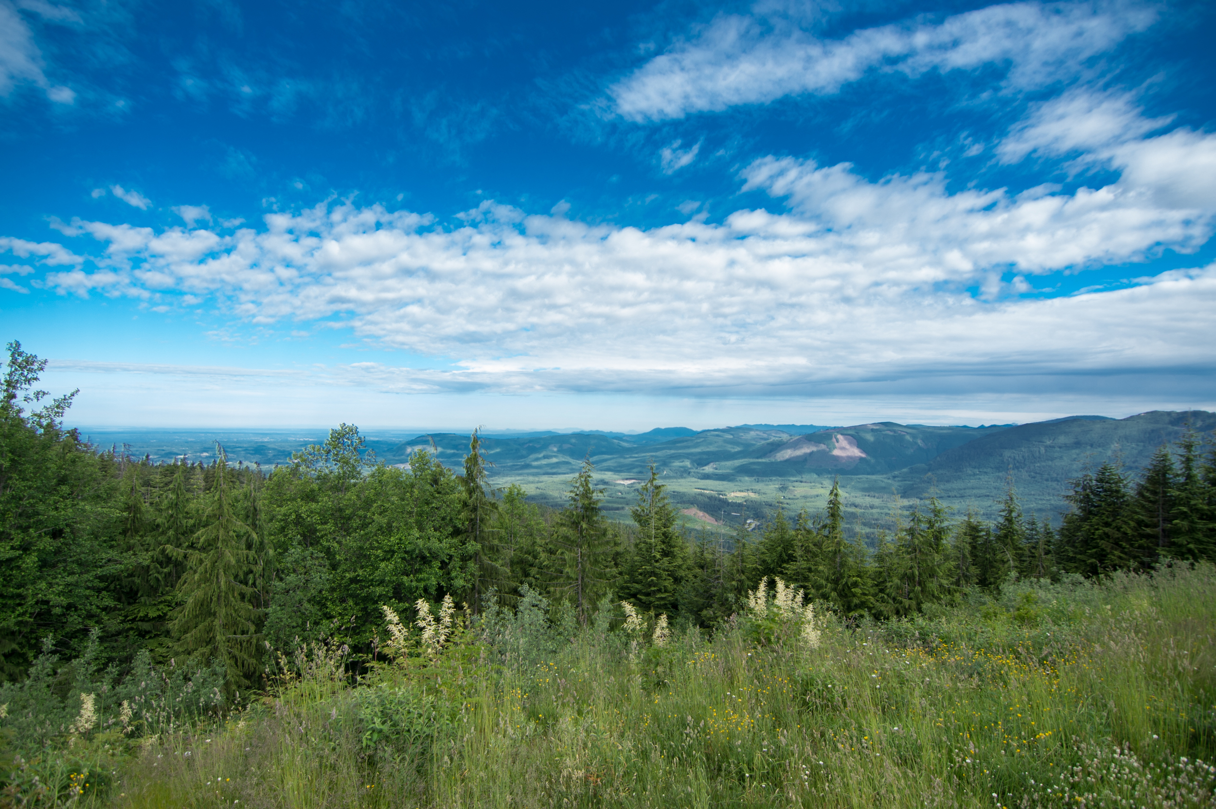
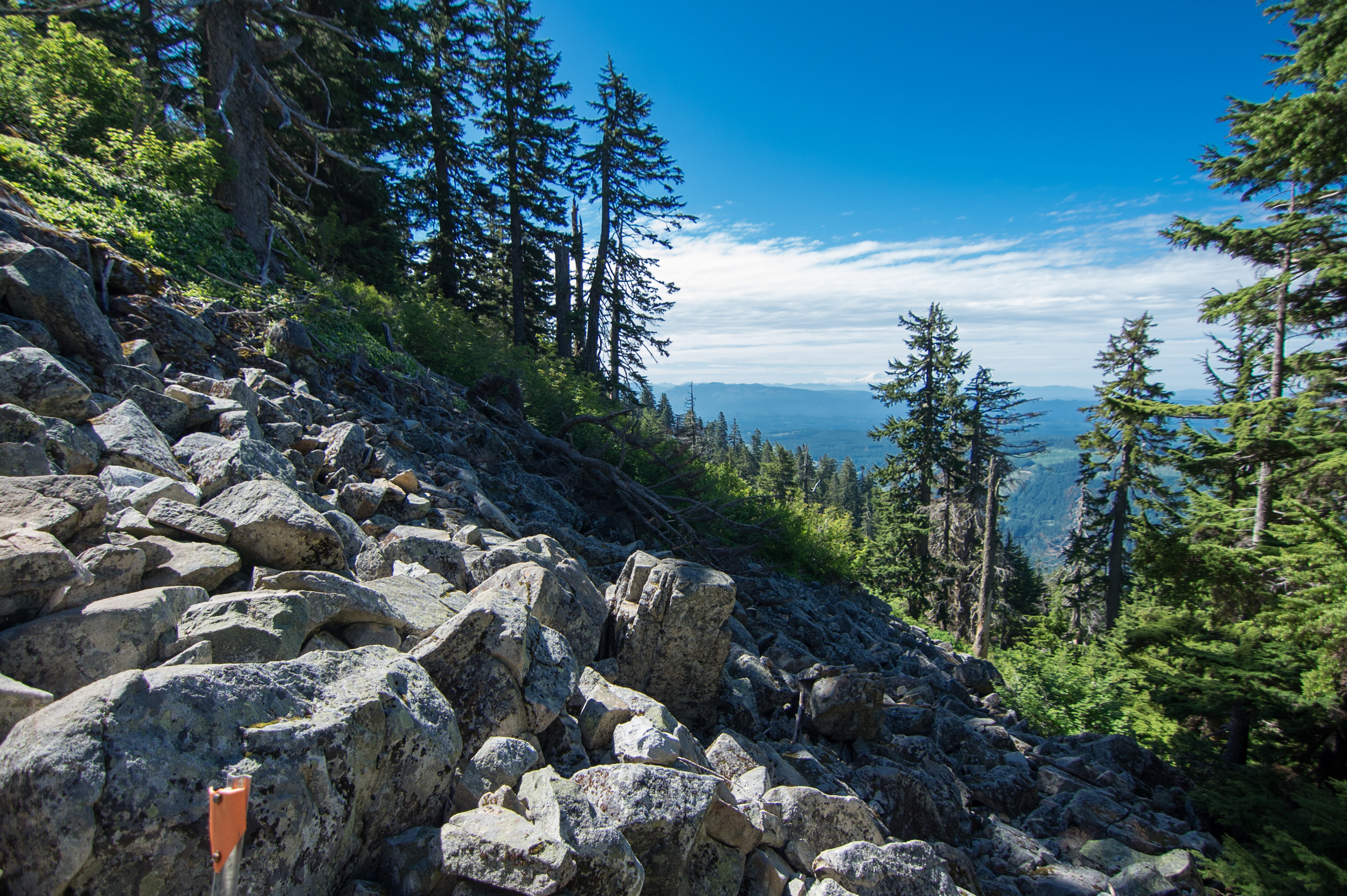
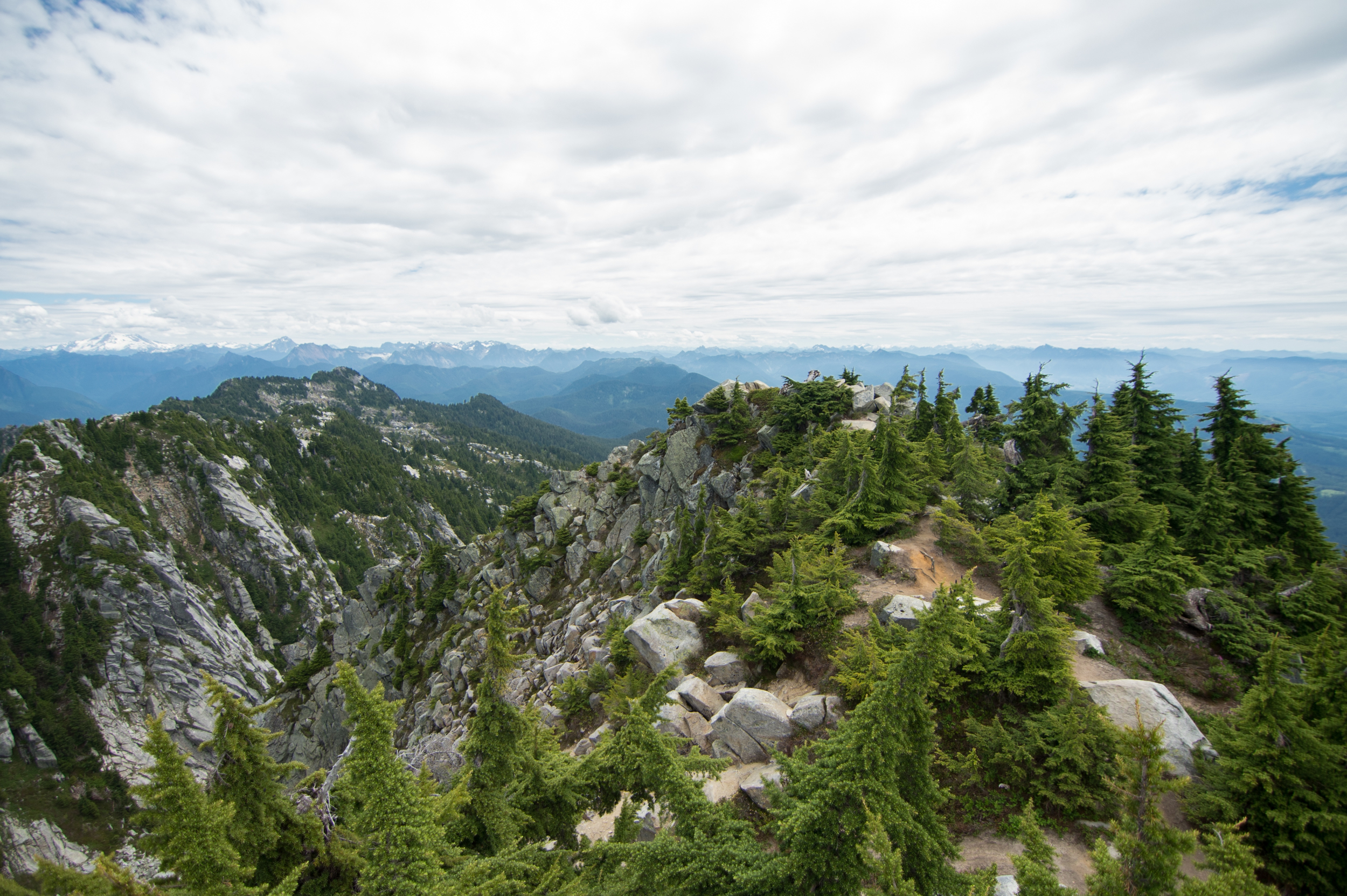
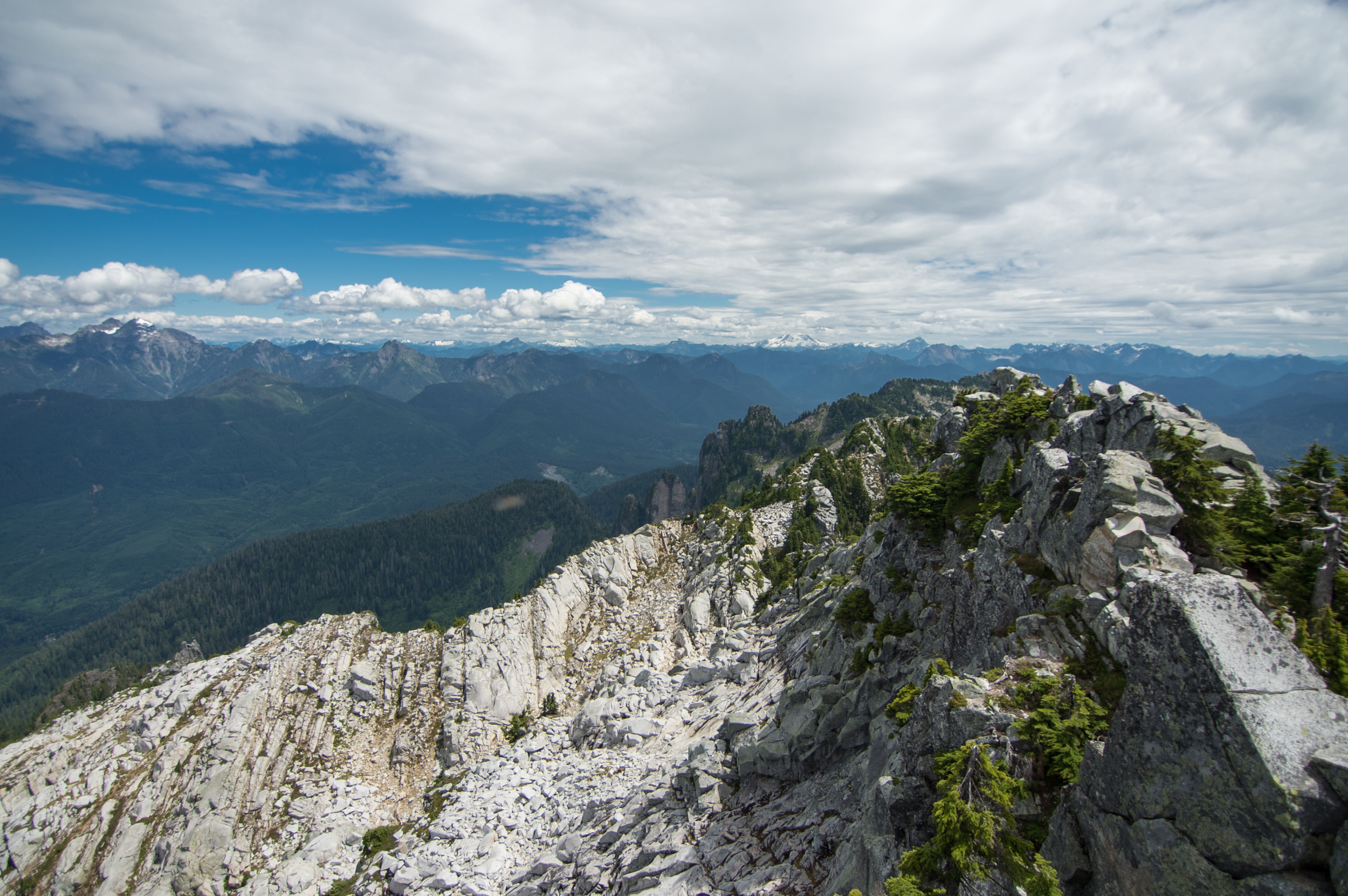
Part 2 is made up of the rocky, agoraphobia-inducing openness that I absolutely love. It opens up into a wide open, 180° view of the same mountain range you saw from the parking lot.
Some people might even decide this view is worth calling it a day. It is magnificent, and gives you that reassuring feeling that you are, indeed, a part of something much larger in this world. Or something like that. As you saunter on, there is an influx of boulders and massive stones while less trees surround you. This is a good sign, for it means you're definitely going in the right direction.

Yeah, that's where you're going. All the way up there. That top thing. The place in the clouds. Don't worry, no oxygen tank necessary. ;) As you work your way up the trail, you will see these rad little orange marker thingies. They signify the edge of the trail, and serve as guides to point you back on course. Remember, follow the brown dusty trail on the rocks!


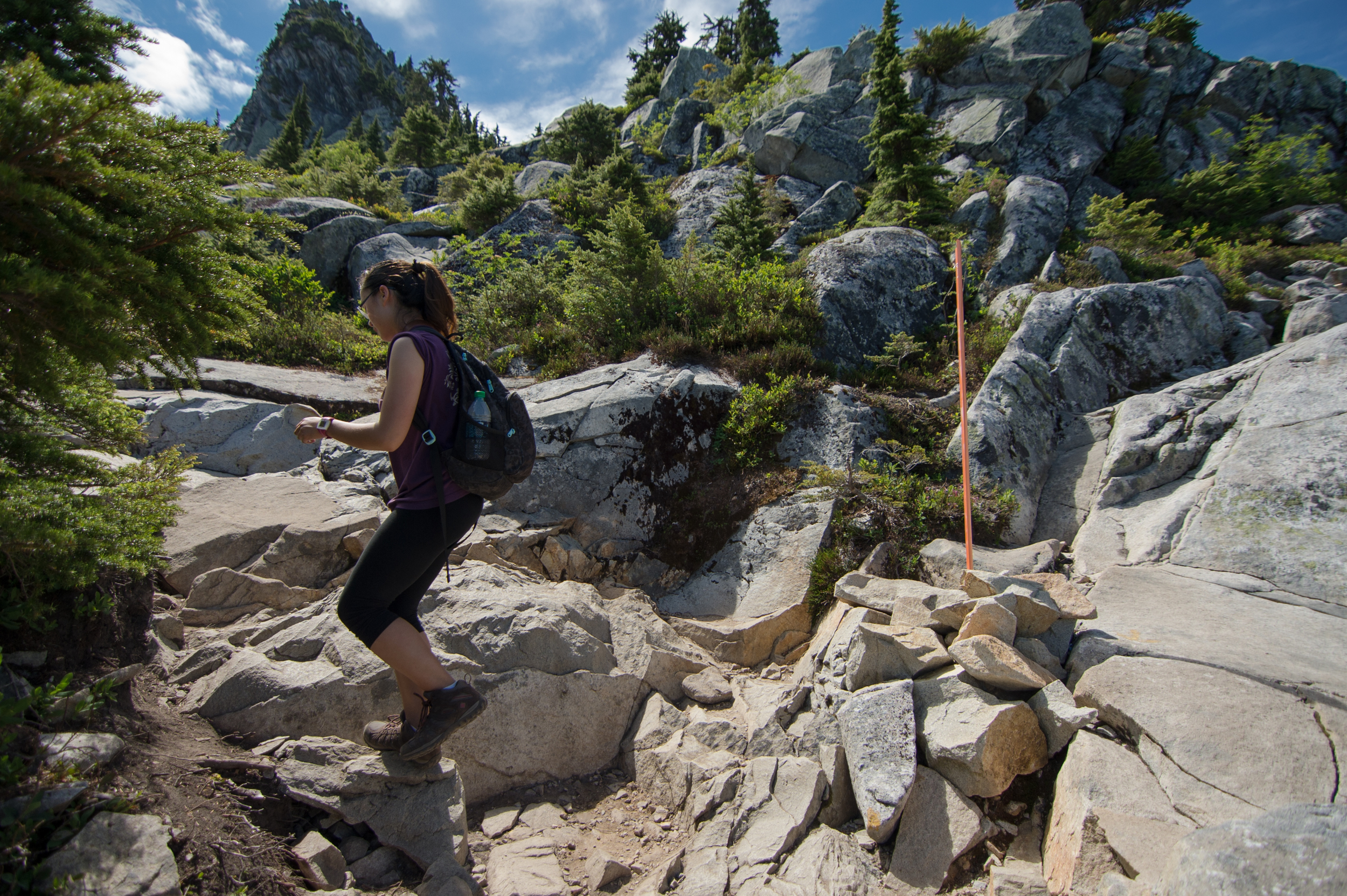


This is a pretty decent-sized portion of the hike. Sure hope you like open spaces.
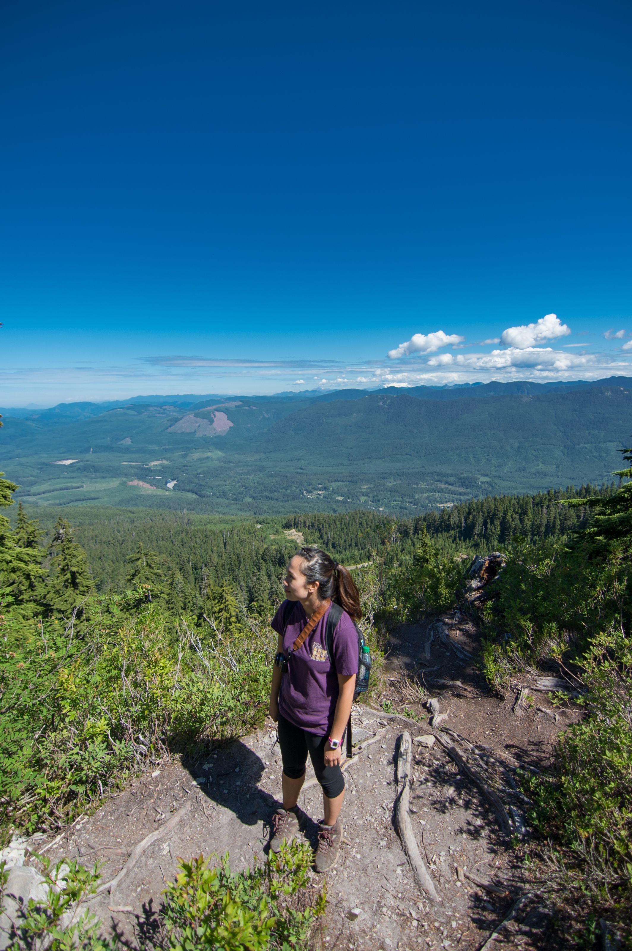
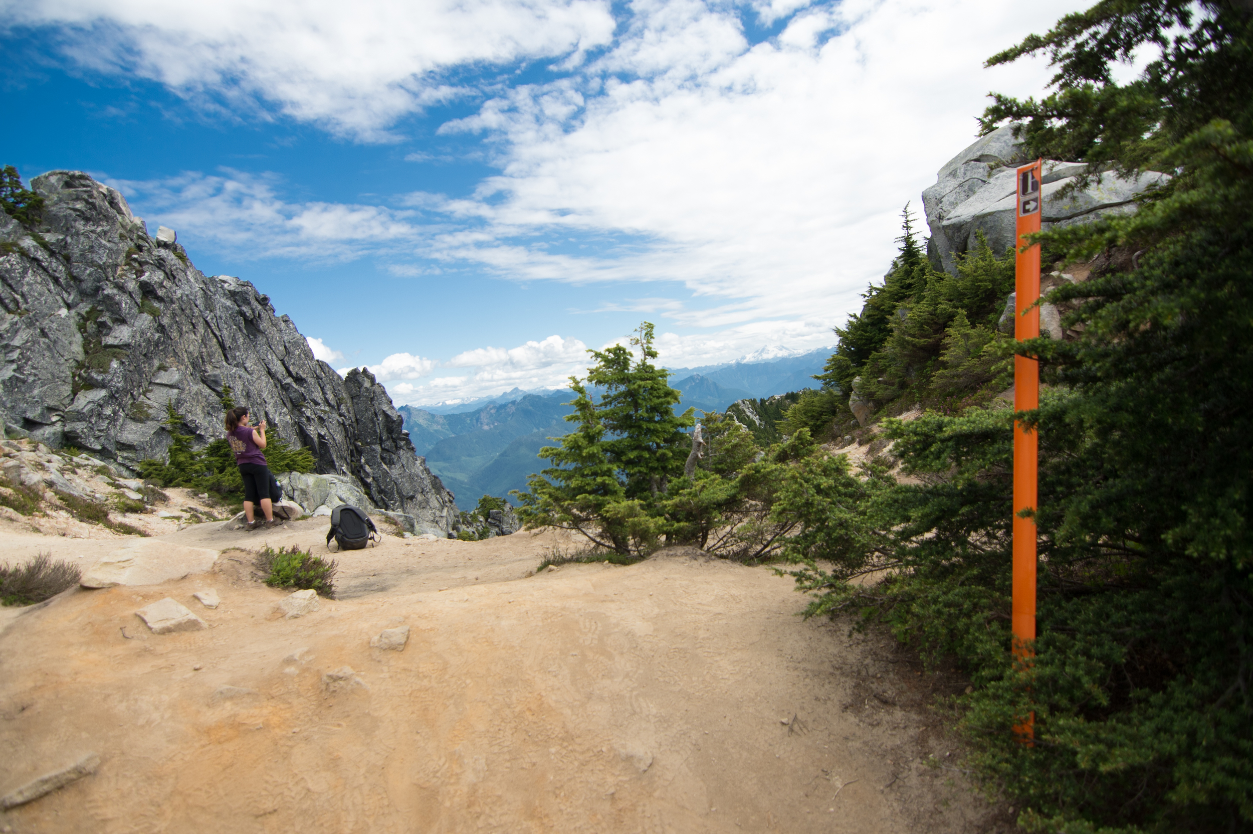
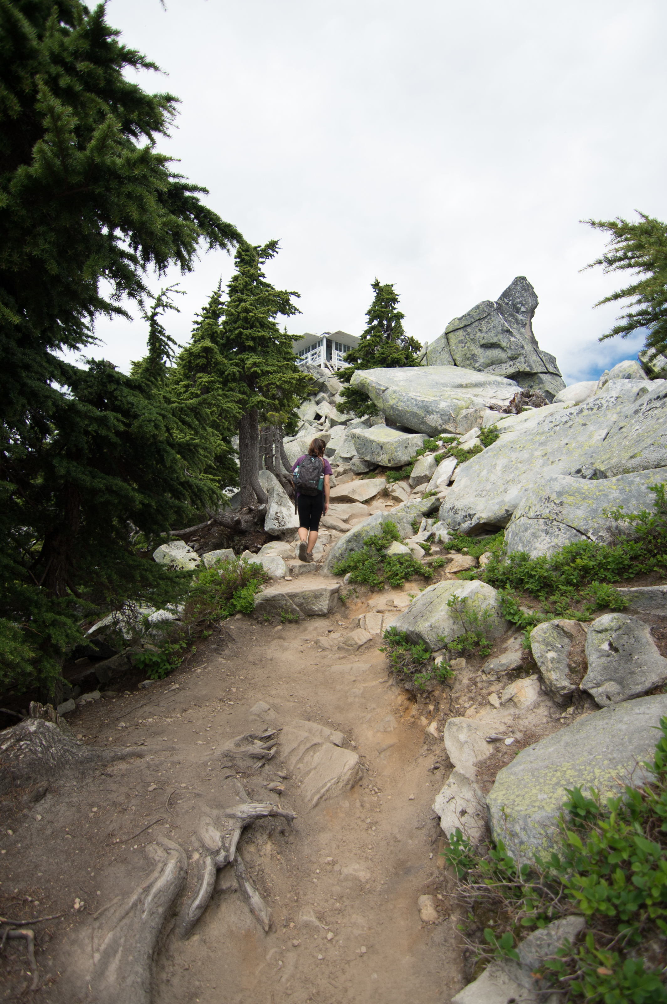
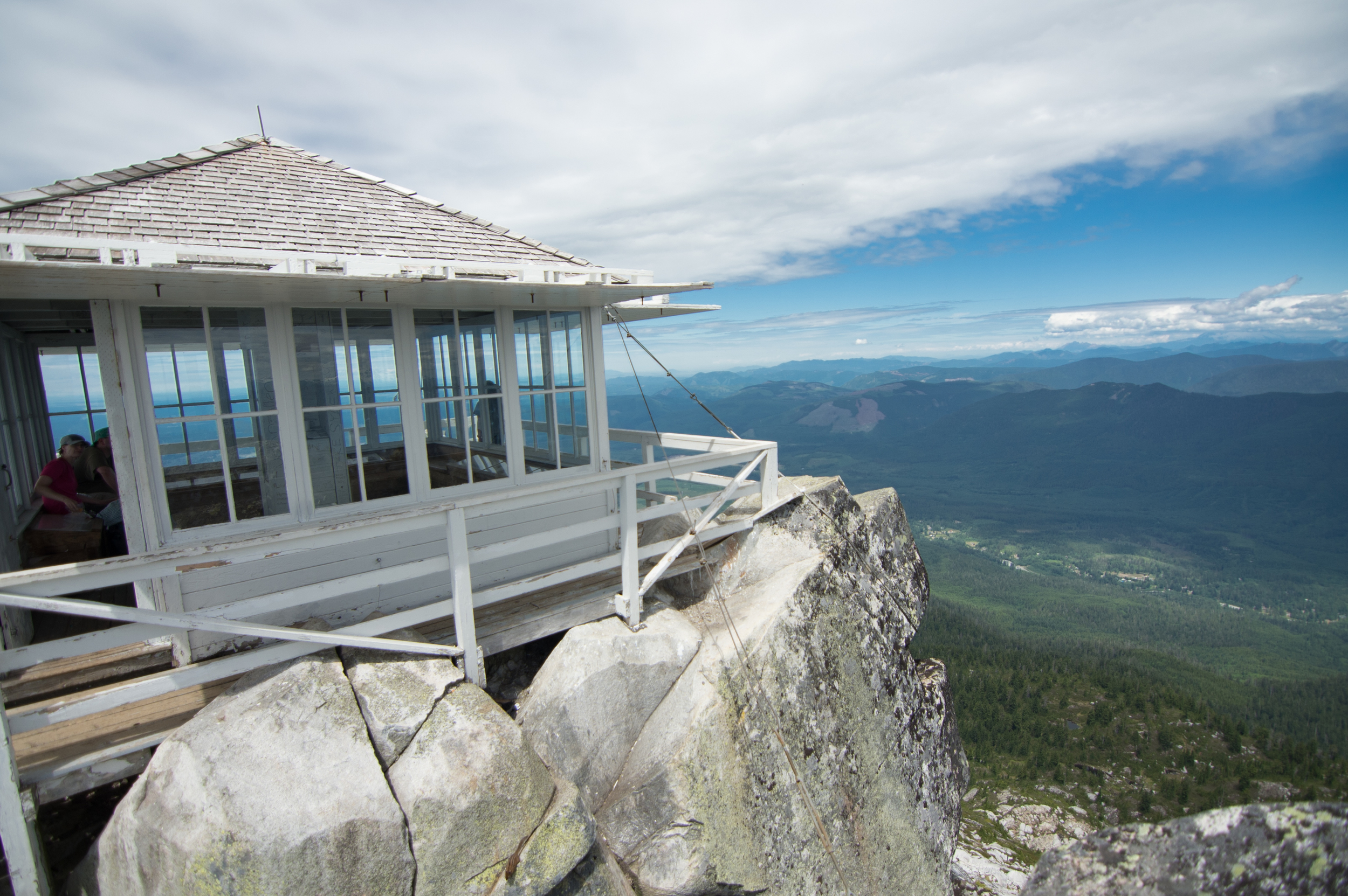
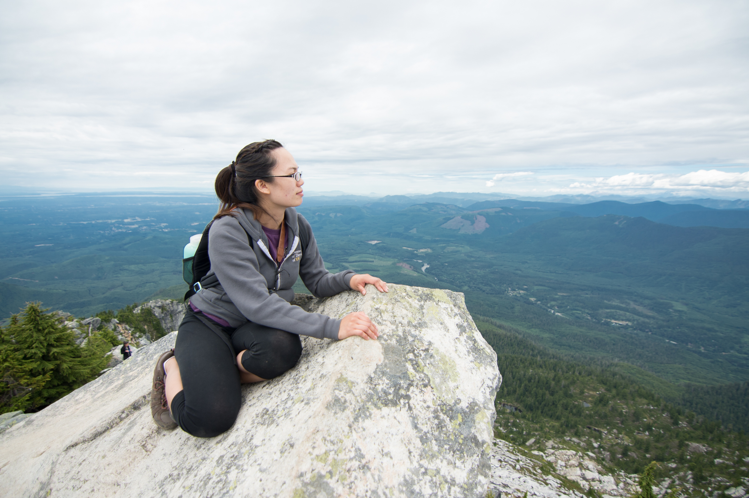
The final section is made up of the final 3 percent of the hike: The summit and lookout tower. There's a final marker on your right as you get there, and you'll know you've made it. The views up 'til now have been grandtastic and phenomenal, but they pale in comparison to what you'll see next.
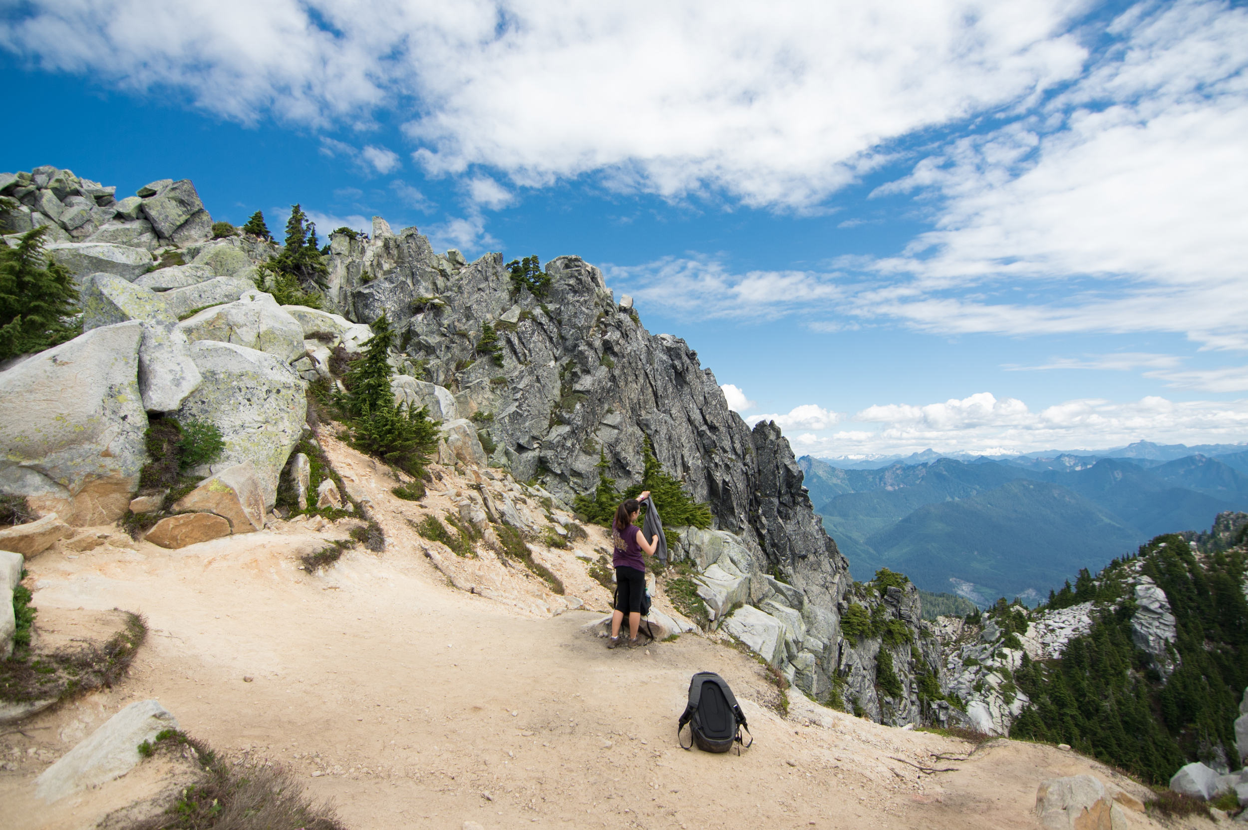
Once you have taken in the sights, there is one final ascension that you must make. There are some boulders you'll need to clamber up in order to reach the pinnacle of your quest.

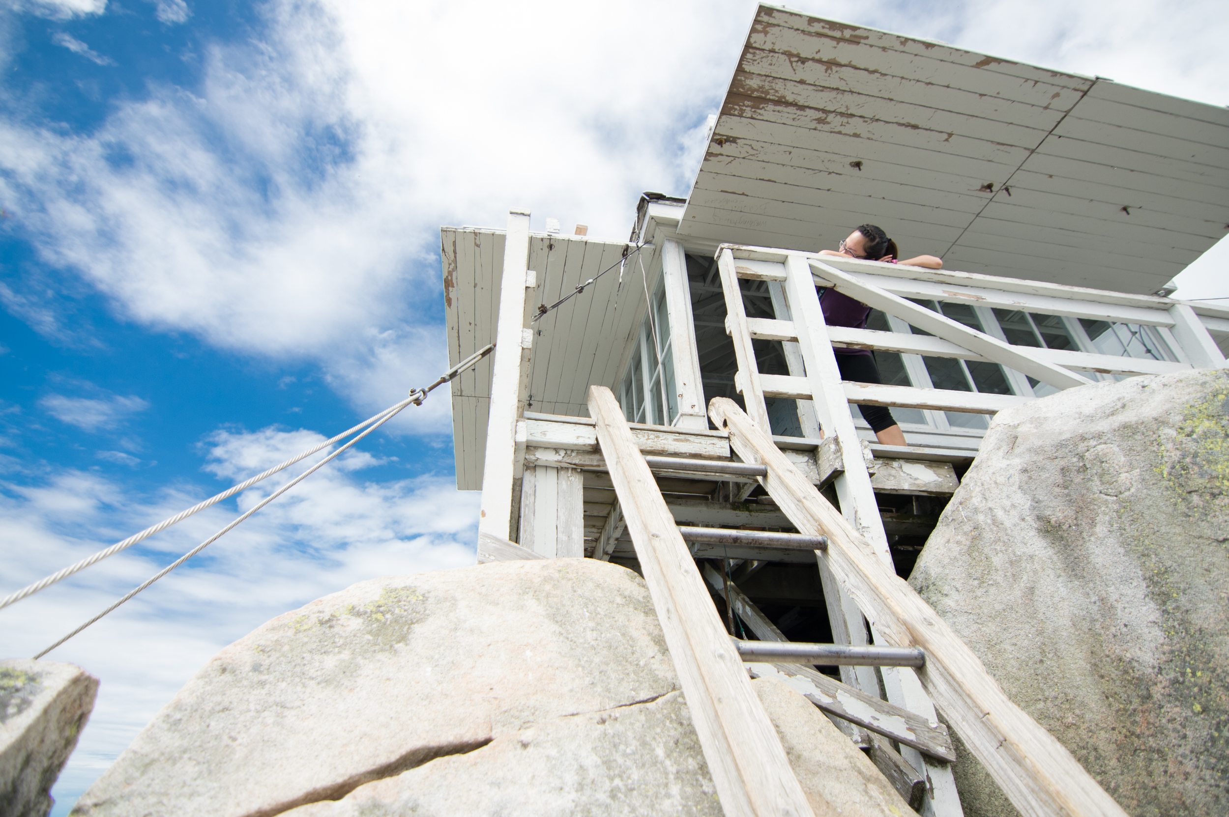
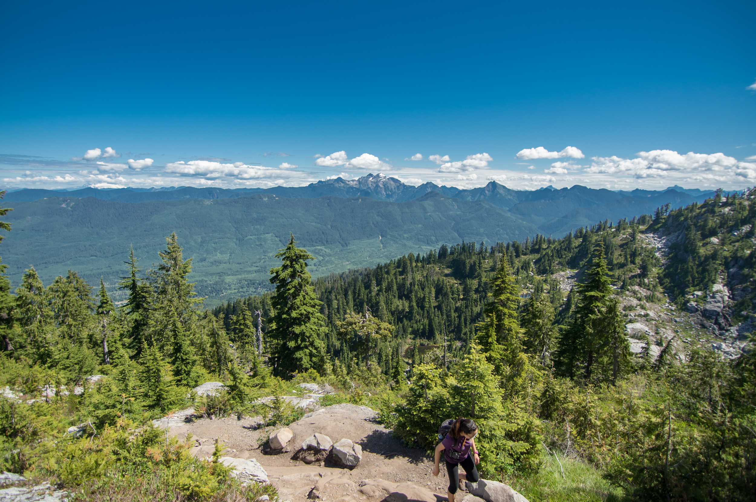
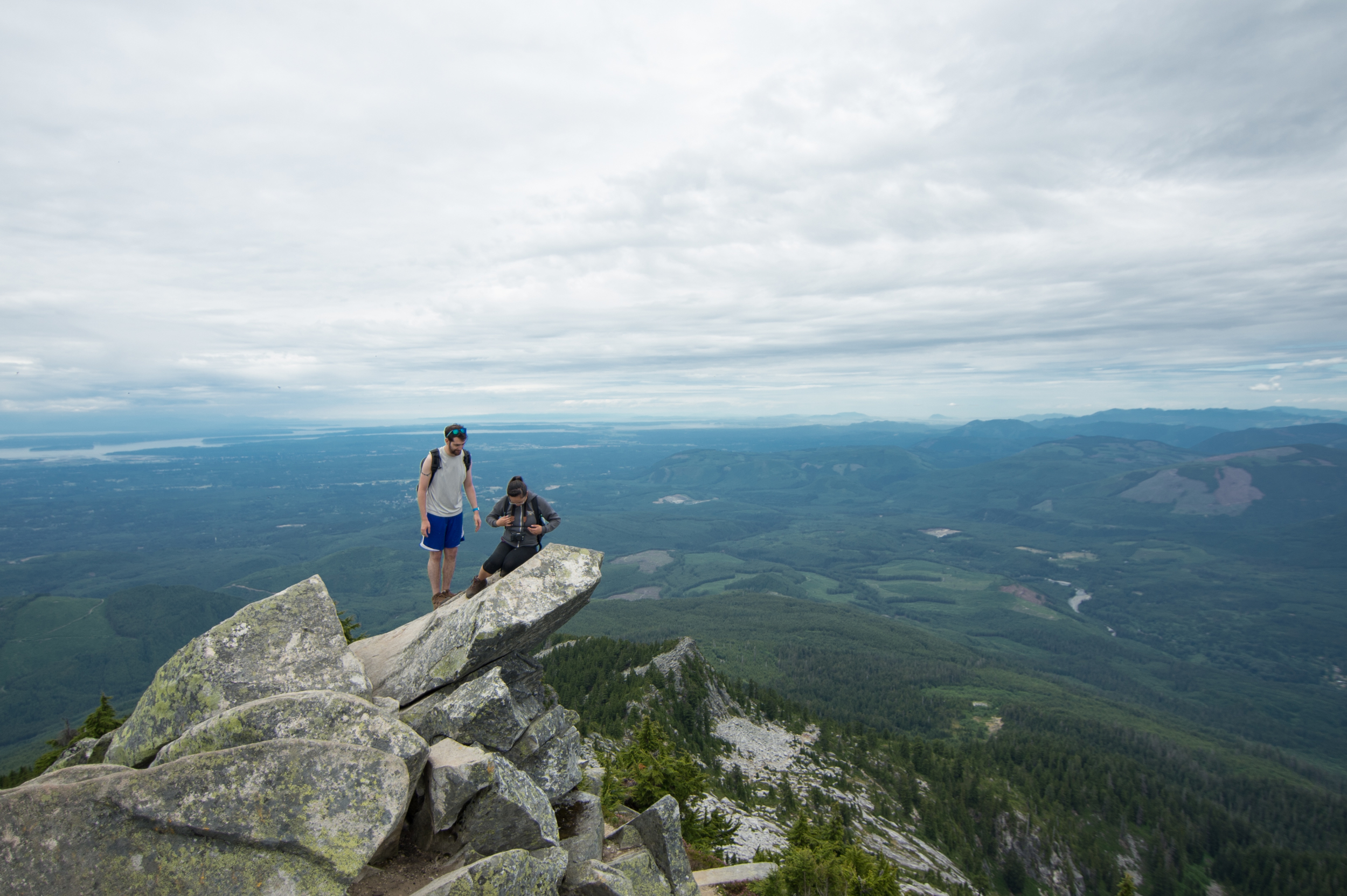
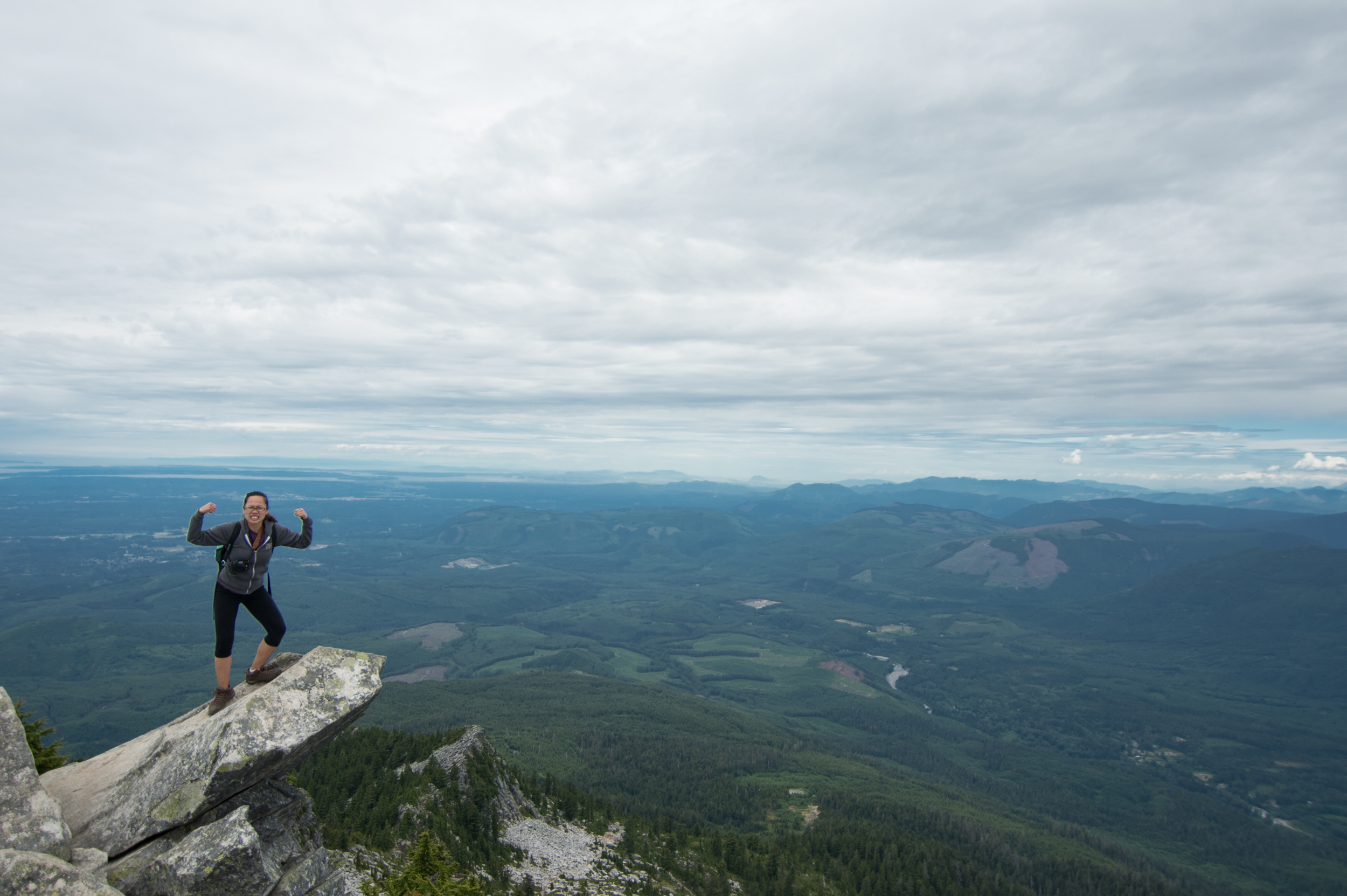
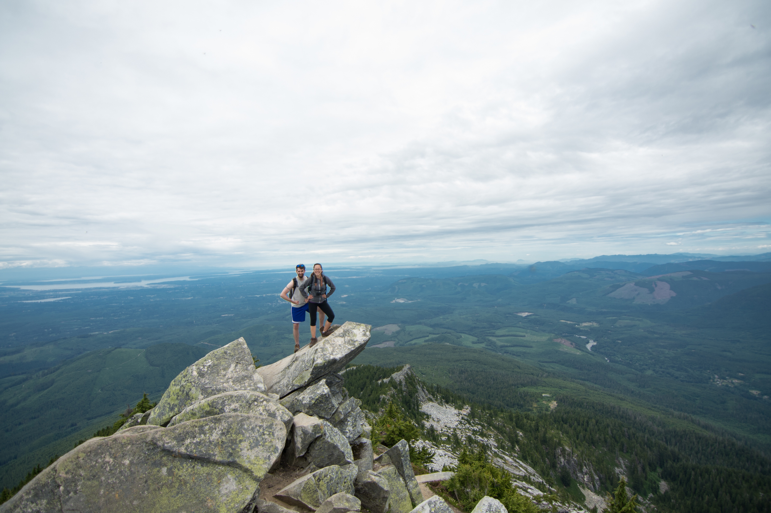
A daring soul may leave the safety of the lookout to venture forth onto The Top of the World. It is SO worth craping your pants to stand up and see everything the light touches. Yeaaaaahhhh, Lion King.
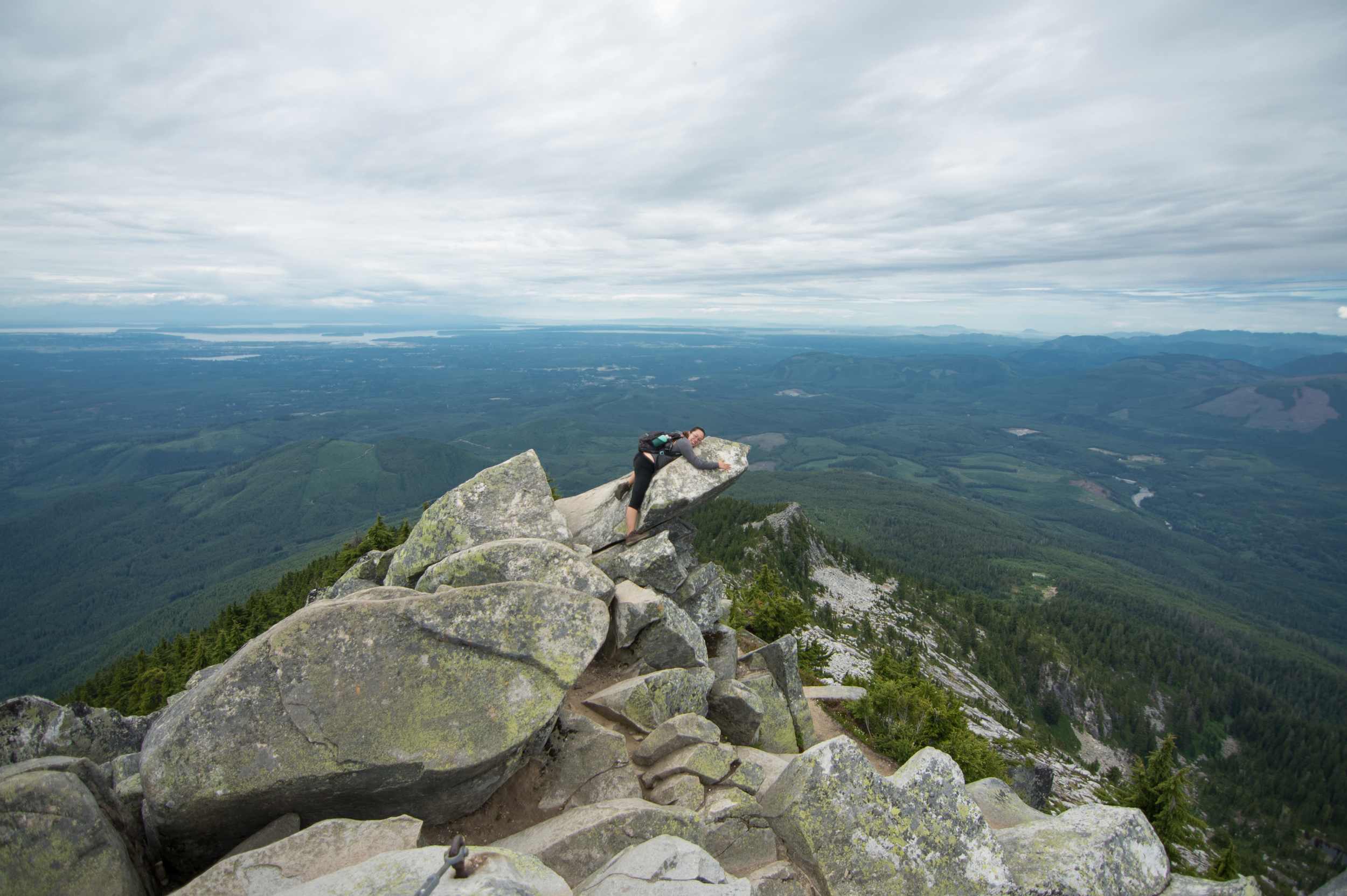
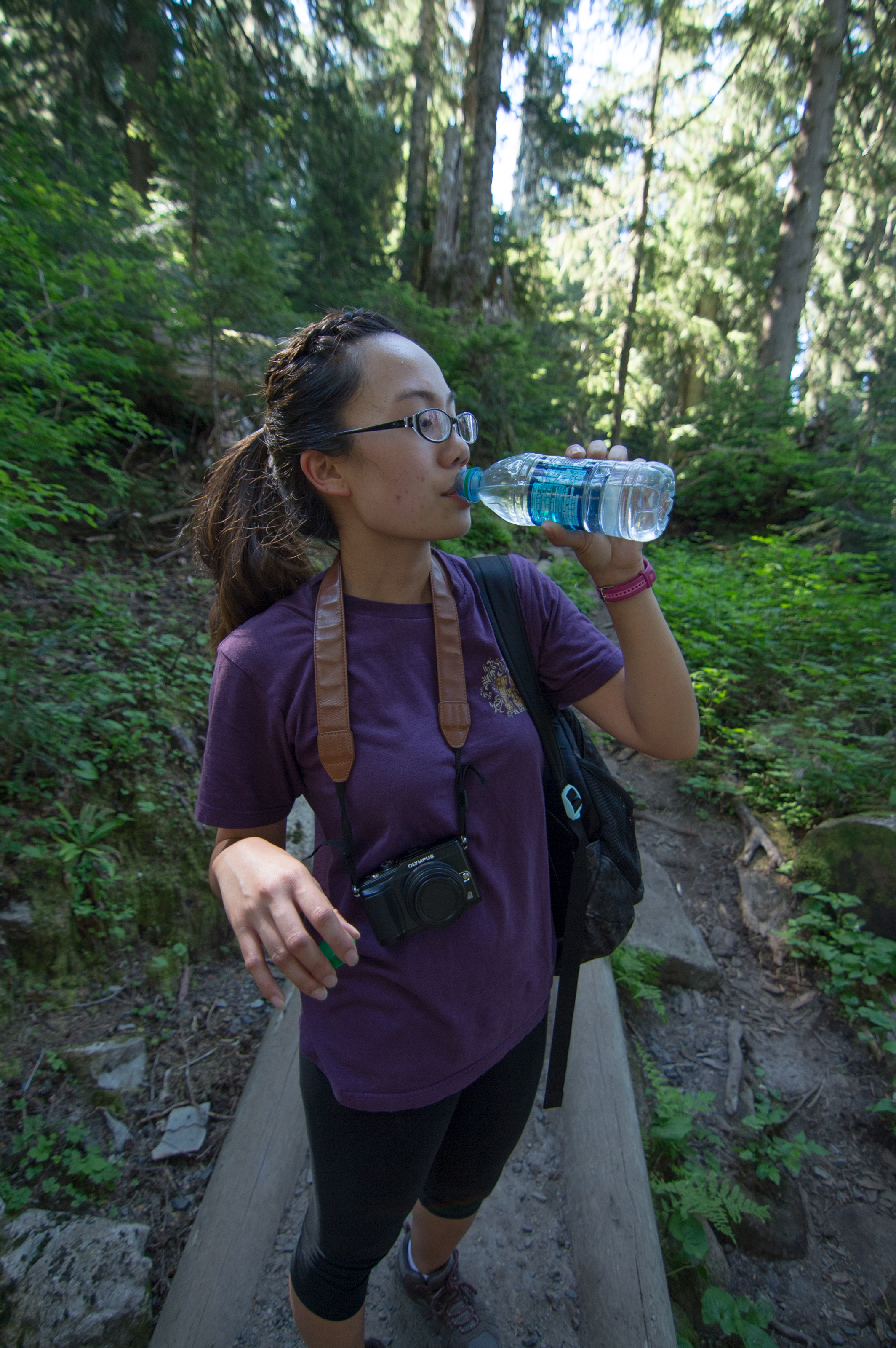
I may or may not have had to talk my girlfriend into standing up on that rock some 4500 feet above the ground, but she has a warrior's spirit like no other and would not be denied her glory.
I cannot stress enough to you, reader, how much you need to stop reading this and get in your car to go hike this mountain. Hands down the greatest hike I have done so far, and reaffirmed to me these times we live in are beautiful. So much wonder and challenge can be found side by side in this beautiful world we live in, and I implore you to explore your backyard.
I am compiling a list of more hikes to do! Please leave your favorite hike in the comments below so I can get started on them! :D Thanks for reading!